Wednesday, June 15, 2016

The Bicycle Ride Across Tennessee is one of the best ways to see the Volunteer State

The Bicycle Ride Across Tennessee is one of the best ways to see the Volunteer State
By:  Michael Lander

The Bicycle Ride Across Tennessee is usually about 400 miles
over seven days and is held annually.  This year's event will be
the 27th one and it will take place 11-17 September 2016.
(Photo:  Courtesy of Tennessee State Parks Ranger -
Daniel Basham)

If you’re looking for a challenging ride, and you want to see some of the best scenery that there is to see in
Tennessee, you need to look no further than the annual Bike Ride Across Tennessee. 

The
Bicycle Ride Across Tennessee (or BRAT) is one of the best ways to see and experience some of the natural beauty that can be found in the State of Tennessee, a state which advertises itself with its official state slogan of “America at its best.”

“The Bicycle Ride Across Tennessee (or BRAT) is an event that is usually around 400 miles, over a 7-day period, with the participants doing about 50 to 80 miles each day through the great state of Tennessee,” Morgan Gilman said.

Gilman is the Sales and Events Marketing Manager for
Tennessee State Parks.

“In addition to the 7-day ride, we also offer an option for participants to only do a single day, a 3-day, and a 4-day ride, too,” Gilman said. 

The upcoming ride in 2016 will take place from September 11 – 17 and this will be the 27th one that has been hosted by the Tennessee State Parks, the
Tennessee Park Ranger Association, and Friends of the Cumberland Trail.

The BRAT has approximately 250 cyclists who participate
in it each year.  This number can vary depending upon the
difficulty of the route, which changes from year to year.
(Photo:  Courtesy of Tennessee State Parks Ranger -
Daniel Basham)

This year, the ride will begin and end at
Cumberland Mountain State Park in Crossville, Tenn. 

Click here for this year’s route: 
https://ridewithgps.com/events/27th-annual-Bicycle-Ride-Across-Tennessee-BRAT-27

For those who do the BRAT, they are treated to seeing some of the most scenic and diverse landscape within a state that is 440 miles long, 120 miles wide, and that has a cumulative total of 42,143 square miles.

From the flat delta region in the west, to the rolling hills in the middle of the state, to the mountainous terrain in the east, those who participate in the BRAT get see this and more as they pass through vast rural areas, small towns, and various landmarks that exist along the way.

“The BRAT began in 1987 and, for the first two years, the ride went from the home of Elvis’ Graceland and the Home of the Blues in
Memphis to the majestic Great Smoky Mountains area of Chattanooga.  The routes were then changed after that with loops around various other areas throughout the State of Tennessee.  Since then, we have tried to change up the routes to give the riders some new experiences and different scenery to look at from year to year,” Gilman said.

The 2014 BRAT began and ended at Tims Ford State Park
with stops at Henry Horton State Park, the City of
Fayetteville, South Cumberland State Park, and Old
Stone Fort Park.  (Photo:  Courtesy of Tennessee
State Park Ranger - Daniel Basham)

“This event now attracts approximately 250 riders each year, but this varies according to the difficulty of the route,” Gilman added.

While the numbers may vary on any given year, the ride continues to attract those who have never done it before and those who keep coming back to do it again.

“BRAT riders are very loyal and they seem to love the ride.  They also appreciate the ranger support and the varied routes through some of the most beautiful areas in Tennessee.  We have many who have participated in it for years and a courageous few who will be doing their 27th BRAT,” Gilman said.

The ride is probably as popular as it is because it is well-supported and everything is planned out with much of what a cyclist would need being provided. 

“The Bicycle Ride Across Tennessee is unique because we have some of the best support staff around – Tennessee State Park Rangers.  Our rangers support riders throughout the route with blue lights when needed, traffic patrol, and EMS services.  We also have three support stops each day that are fully stocked with food, water, and Gatorade.  We also have a bike mechanic who is on the route each day with riders for any bike issues that might arise and one that’s stationed at the camp each night,” Gilman said.

The route is marked with spray paint and signage and all cyclists receive a cue sheet, along with downloadable GPS files, to ensure that they don’t get lost or get off course.

Cyclists who participate in the BRAT receive all the support
that they need from Tennessee State Park Rangers who
help to make the ride one of the best in the state.
(Photo:  Courtesy of Tennessee State Park Ranger -
Daniel Basham)

“In 2016, the cost for the full 7-day ride is $400 for early registration.  This fee includes 2 meals each day, 3 rest stops that are fully stocked, campsites, hot showers, bike mechanic services, a t-shirt, and entertainment,” Gilman added. 

Those interested in doing the BRAT, can register at
http://www.imathlete.com/events/BRAT2016

Gilman suggests that you travel light and that you bring a bag to store your belongings that is waterproof and made of a sturdy material that will hold up for the week.  You are allowed 2 bags per rider and each bag should weigh less than sixty (60) pounds since you may, otherwise, have trouble loading and offloading them from the baggage trucks.  You will also want to mark your bag and you should avoid any sharp edged straps or buckles on the outside.

To ensure that your clothing stays dry, he recommends packing them in large plastic bags, pressing them flat to remove the air, and then sealing them.

Cyclists are treated to a wide variety of beautiful scenery
and a great diversity of terrain throughout their 400-
mile trek around the State of Tennessee.  (Photo:
Courtesy of Tennessee State Park Ranger -
Daniel Basham)

Some of the gear that Gilman suggests that you bring includes a helmet, sunglasses, water bottles, (or some other way to hydrate), tubes, tire levers, patch kit, etc., cycling clothing with short-sleeve jerseys for the week, long sleeves (for cold or rainy days) cycling shorts, wind breaker, bike shoes, gloves, shoe or toe covers, camp clothing that consists of shorts, long pants, socks, underwear, short and long sleeve shirts, walking shoes, a hat, gloves, rain gear, a warm jacket, toiletries that include a towel, washcloth, toothbrush, toothpaste, sunscreen, lip balm, chamois butter, soap, shampoo, medications, Band-Aids, calamine lotion, insect repellent, a tent, ground cloth for the tent, a sleeping bag, camp pillow, a flashlight (with extra batteries and bulbs), and any miscellaneous items like a camera, a pocket knife, reading material, personal identification, cash and something to put your dirty clothing into.

To read and learn more about the Bicycle Ride Across Tennessee, visit the
BRAT website and their facebook page.

Friday, June 10, 2016

Riding the Ohio & Erie Canal Towpath Trail should be on every cyclist's 'must do' list

Riding the Ohio & Erie Canal Towpath Trail should be on every cyclist’s ‘must do’ list
By:  Michael Lander

If you're looking for a way to satisfy your urge to ride
your bike through areas that offer the best that nature
has to offer, the Ohio & Erie Canal Towpath in
Cuyahoga Valley National Park may be exactly
where you need to go.

Along a once-great canal system, with several towns nearby, and located in the heartland of America, is a place of perfect serenity and natural beauty with wetlands, forests, and fields, and a river that has attracted people to it for many a millennium.

The canal system that once existed in this pristine paradise was known as the Ohio & Erie Canal and while only remnants of the canal still exist today, the tow paths that ran alongside it, that were originally used by horses or mules towing barges, are now popular multi-use trails that attract cyclists, runners, and others to the incredibly scenic area, a portion of which is in Cuyahoga Valley and in the
Cuyahoga Valley National Park.

The Ohio & Erie Canal Towpath is
extremely popular and is perfect
for a nice, leisurely bike ride.

The name “Cuyahoga,” is said to have originally come from Native American Indians and it translates to the word, “crooked,” which accurately describes the Cuyahoga River and how it weaves its way, twisting and turning, at the base of hills and valleys, as it travels over 90 miles of terrain in a U shape from its headwaters 30 miles east of
Cleveland south to Akron, Ohio. 

The river then makes a U turn and flows north through downtown Cleveland and finally into Lake Erie.  The overall U shape, along with the crooked path, is how it earned its name.

The towpath trail, as of today, is approximately 85 miles long and it is one of Ohio’s longest, most scenic, and one of the more popular trails in the region.  It was voted 2015 ‘Best of Ohio’ Bike Trail by readers of Ohio Magazine.

The towpath trail is currently about 85 miles long, but,
when all is said and done, it is expected to be 110
miles long, altogether.


“People love this trail.  The section in Cuyahoga Valley National Park is about 20 miles from Rockside Road in Cleveland to Bath Road in Akron and we get over two million visitors to our national park each year with a large percentage who also visit the towpath trail,” Pamela Barnes said.

Barnes is the Cuyahoga National Park Community Engagement Supervisor.

“The Ohio & Erie Canal Towpath Trail is not yet complete, but it will eventually be 110 miles long, from Cleveland to New Philadelphia.  Progress is being made, and the section in downtown Cleveland, for example, is making some headway and people can keep up with any updates on the progress of this by going to the
Ohio & Erie Canalway’s website,” Barnes said.

The Cuyahoga Valley National Park has over 2 million
visitors each year, many of whom either ride their
bikes, run, or walk on the towpath whenever they do
come.

The Canalway’s website is also a good source for finding out about the many connections that there are to the towpath, according to Barnes.  There is also a Buckeye Trail that, like the towpath, is one of the 125 miles of trails that run throughout the park.

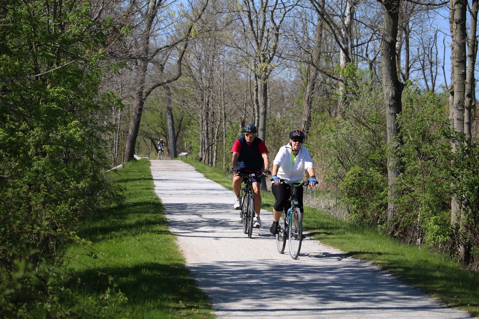
For the most part, the towpath trail is also relatively flat, which makes it very appealing to people of all ages, particularly those who prefer a more leisurely and recreational type of bike ride.

Visitors to the towpath can see a very diverse landscape
with wetlands, forests, and fields that are home to a
great variety and abundance of different types of
plants, trees, and wildlife.

“The trail does have some paved sections and the unpaved sections have crushed limestone, which is very smooth so it is not a problem for cyclists.  It is also very popular with runners as well since it is a softer surface for them,” Barnes said.

The trail is also open all year-round and the park service does not clear the snow since that makes it more attractive for those who want to do some cross-country skiing on it.

There are many places for visitors to
see along the towpath to include the
Boston Store, which can be seen in
the background.

In warmer weather, when cyclists and others come to the Cuyahoga National Park, there is no shortage of things for them to check out and see while they are there.

“Our newest attraction in the park is the
Canal Exploration Center.  It is right next to Lock 38 along the towpath and it contains hands-on exhibits that tell the story of the canals in Ohio.  Outside, Lock 38 is a working lock and on weekends in the summer, costumed staff and volunteers demonstrate the operation of the lock,” Barnes said.

Cyclists and others on the towpath will see the remnants
of the Ohio & Erie Canal with markers that provide
details and historical information for those who are
interested in learning more about them.

Those who wish to learn more about the history of the towpath, can visit: 
http://www.ohioanderiecanalway.com/Main/Home.aspx and https://www.nps.gov/cuva/index.htm.

“Visitors to the towpath will find remnants of other locks, wetlands, wildlife views, the
Hale Farm and Village, the Hunt House, the Blossom Music Center, the Porthouse Theater, and the Boston Visitor Center.  They can also purchase refreshments and souvenirs at Trail Mix Boston and Trail Mix Peninsula, which are stores that are operated by our partner – the Conservancy for Cuyahoga Valley National Park,” Barnes said.

Remnants of the Ohio & Erie Canal can be found
along the towpath and throughout the Cuyahoga
Valley National Park.  This is one of the locks
located near the Boston Store.

“There is also, the
Cuyahoga Valley Scenic Railroad which operates an extremely popular ‘Bike Aboard’ program.  For $3, cyclists can ride the towpath in one direction, put their bicycle on the train and then ride the train back to their car from there.  It runs Wednesday through Sunday.” Barnes added.

Conservation efforts to restore the natural beauty surrounding the towpath trails, and to protect against the encroachment of development, began over 40 years ago when individuals united together with state and local governments to save the precious greenspace and to preserve the area’s history.

Visitors to the towpath are rarely far from the Cuyahoga
River, which was an essential part of the Ohio & Erie
Canal system.  Most of the towpath is flat and it is
either paved or has crushed limestone on it.

“The 33,000-acre national park was established in 1974, and we worked to restore our section of the trail, which opened in 1993.  The designation of National Heritage Area makes funding available for restoration of other sections.  Local Metropark systems have taken on restoring and maintaining the sections within their own jurisdictions,” Barnes said.

“There are a lot of wonderful trails in Ohio, the Ohio and Erie Canal Towpath Trail is a great example of how groups working together can help to maintain an asset and accomplish something that can promote the health and wellness of the people of northeast Ohio,” she added.

A concerted effort by citizens, local, and
state government over 40 years ago
helped to save the greenspace and the
history that visitors can now
appreciate and enjoy today.

Cyclists who ride the towpath should find it to be a very pleasant and enjoyable experience, but Barnes recommends that there are a few things that they should keep in mind that will make it a safer experience for them and others.

“Cyclists should always wear a helmet, stay to the right and warn others that they are passing.  They should also yield to horses since there are a few places that intersect with horse trails, and they should slow down in congested areas where there may be people walking, who have strollers, and young children with them,” Barnes said.

The towpath is one of the longest and most popular trails in
Ohio.  Visitors can easily get on to it from numerous access
points along the way.

“Also, if cyclists are listening to music, they should keep one ear open to hear what is going on around them and they should be careful when coming up to wooden bridges or boardwalks since they can be slippery when wet,” she added.

In addition to dozens of things to see and do in the Cuyahoga Valley National Park, there are some current and future amenities that should be of great interest to cyclists who want to have an extended visit there.

The towpath is especially enticing to cyclists, along with
those who would prefer to run or walk on it throughout
the year, but it is particularly popular on weekends and
holidays in the warmer weather months.

“There are plans for more infrastructure for those who would like to take multi-day trips.  We already have 6 back-country campsites that cyclists can use for this purpose, which are located just north of the Boston Store Visitor Center.  They are accessed by a short connector trail from the towpath.  They can be reserved through the
Conservancy for Cuyahoga Valley National Park,” Barnes said.

Whether it is for a short or long visit, cyclists who come and ride the Ohio and Erie Canal Towpath trail will likely not leave without wanting to come back again in the future and it should definitely be on the 'must do' list for those who have never been there and experienced it for themselves.

Sunday, June 5, 2016

The Bicycle Museum of America is a 'must see' for anyone who truly loves bicycles

The Bicycle Museum of America is a ‘must see’ for anyone who truly loves bicycles
By:  Michael Lander

The 1816 Draisine was created by Baron Karl von Drais de
Sauerbrun and it was the first bicycle with a steering
mechanism that was affixed to the front wheel.  The
one at the Bicycle Museum of America is one of only
six that are known to still exist.

Author and
Nobel Peace Prize winner, William Saroyan, once said that, “The bicycle is the noblest invention of mankind,” and Lord Charles Beresford insisted, that its inventor, “deserved the thanks of humanity.”

Those, like Saroyan and Beresford, who have a deep affection or an appreciation for bicycles will find one of the best collections of them in the U.S. at the
Bicycle Museum of America in New Bremen, Ohio.

Even though it was called a velocipede by its manufacturers,
the Boneshaker is considered to actually be the first true
bicycle with pedals.  It earned its distinctive name because
of its rough ride, which was caused by its wrought-iron
frame with wooden wheels made of iron.

The bicycle museum, which is in a 3-story, 14,000 square foot historic building in downtown New Bremen, is one of 13 bicycle museums in the U.S.

It is located 108 miles north of
Cincinnati, Ohio in the quiet, rural part of west central Ohio.

For anyone who truly loves bicycles, the museum will make them feel like a kid who has been let loose in a candy store.

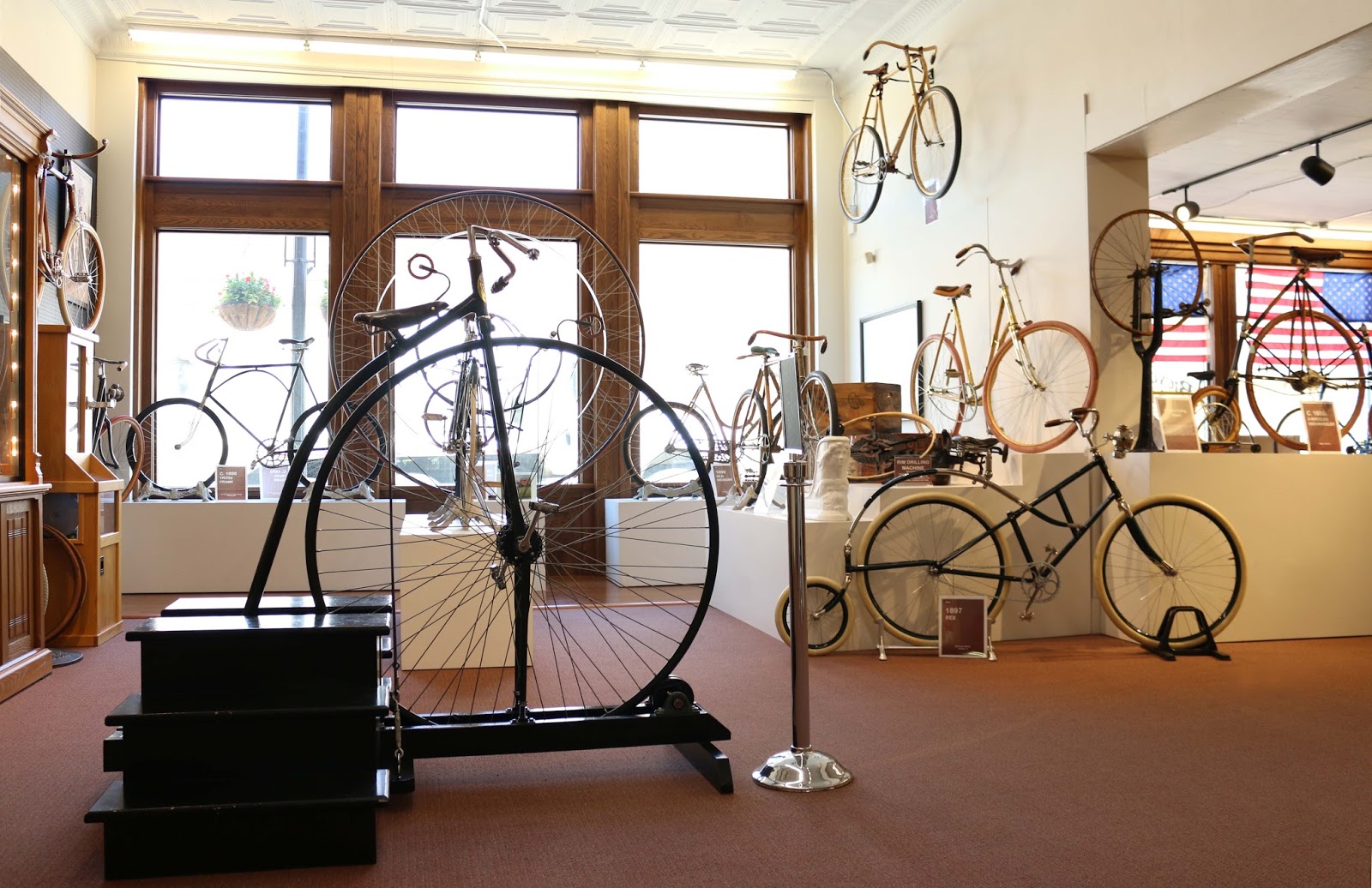
The Bicycle Museum of America has a sizeable collection of
bicycles and bicycle-related paraphernalia and memorabilia
in their 14,000 square building in New Bremen, Ohio.

The museum coordinator, Becky Macwhinney, described the museum as being “one of Ohio’s best kept secrets and treasures that is open to be shared by all.”

It is there that the lover of bicycles, or cycling aficionados, are treated to an extensive collection of bicycles like none other.

Those who visit the museum get to experience what is almost like walking back in time and see the evolution of bicycles, spanning over two centuries.

The Bicycle Museum of America has a couple of displays that
show how bicycles played a significant role for women in
the early 20th Century.  The renowned suffragette, Susan
B. Anthony, said that she thought that the bicycle had done
more to emancipate women than anything else in the world
and in giving women a feeling of freedom and self-reliance.

There are over 200 bicycles on display in the museum at any given time with an additional 800 more in storage.  There is also an impressive array of antique bicycle accessories, lamps, head badges, old photos of cyclists, posters, advertisements, signs, medallions, patches, and countless other cycling-related memorabilia. 

From the wonderfully-handcrafted antique bicycles of yesteryear to the sleeker, lighter weight, and more aerodynamic bicycles that are manufactured, today, the museum seems to have it all.

The vast collection of bicycles at the Bicycle Museum of
America is made all the more impressive by the
tremendous amount of cycling-related items and
materials that accompany the displays.

Among some of the most notable bicycles is an
1816 Draisine, which is one of only six that are known to exist in the world.  In addition to that, the museum also has an 1850 Ward Quadricycle, an 1870 Boneshaker, an 1881 American Star, an 1887 American Safety, an 1891 Victor Light Roadster, an 1897 Waverly, an 1898 Old Hickory, and so many others.

"The entire first level of the museum tells the history of the bicycle and its development.  It contains beautiful examples of the workmanship of the early builders in their creation of the velocipedes, high wheels, and early chain and gear-driven bicycles," Macwhinney said.

"Carrying through on the old and new theme, we have wooden bikes of the 1880's and wooden bikes made within the last 10 years.  We also have sections dedicated to motorized or military bikes for anyone looking for those," Macwhinney added.


While there, visitors can also learn about the role that bicycles have played, historically, for women, and the vast number of uses that bicycles have had over the years to include military applications and the development of our roadways, themselves, that first came about because of the bicycle, itself.

The third floor has an enormous collection of Schwinn and
Huffy bicycles with some made by Harley-Davidson when
they were still in the business of manufacturing bicycles.

"The museum attempts to bring out the various factions in which the bicycle has been effective, such as the early use of varying materials, gearing, chains, mass production, uniform parts, and assembly line construction," Macwhinney said.

"We also emphasize the fact that bicycles have long been considered by many as a serious form of transportation and they encouraged the development of good early road systems that have eventually benefited all of us today," she added.


Even though many visitors to the museum might arrive by car, there are some who get there by way of a bicycle and cyclists can ride on the roads or on one of the nation’s largest paved trail networks known as the
Miami Valley Bikeways.

"We often have, for example, individuals or groups who are riding their bikes across the U.S., or parts of it, who stop in for a visit, along with some trike groups out of Indiana who come annually, and some from the Great Ohio Bike Adventure (GOBA) who come through on occasions, boosting our attendance by several thousand," Macwhinney said.

"The Bicycle Museum of America began in 1997 when James F. Dicke II purchased an enormous collection of Schwinn bicycles from a museum at the North Pier in Chicago who put them all up for sale. 

Dicke is an Ohio businessman and philanthropist and the Chairman and CEO of
Crown Equipment Corp., which is a global forklift manufacturer and material handling provider.

Many of the more contemporary, modern-style bicycles
that most people, today, are familiar with can be
found on the second floor of the Bicycle Museum of
America.

With deep family roots and his company being located in New Bremen, Ohio, it is not surprising that Dicke would chose that as the place for the bicycle museum.

It also seems fitting that the museum has found its home in Ohio since the state of Ohio has had a rich history with the bicycle.  The
Wright Brothers, who were pioneers in flight, had a bicycle shop in Dayton and in 1892, the Davis Sewing Machine Company produced the famous Dayton bicycle.

From the inception of the bicycle, each decade seems to
have their own unique look and style like these two in
the forefront, which are from the 1930's.
 
Ohio has also been home to prominent bicycle manufacturers, over the years, that include
Huffy in Dayton, and five others that are now gone, but not forgotten, which has included Colson of Elyria, the Shelby Cycle Company, the Cleveland Welding, which produced the Roadmaster, and the Murray Ohio Manufacturing Company that made the Roadster.

In addition to the wide ranging type of bicycles, (some of which may seem strange, unusual, or even revolutionary), visitors to the museum will also find some other interesting items on display such as a collection of gemstones and even a large Civil War era U.S. flag carried by Company C of the 37th Ohio Infantry for Auglaize County.

Visitors to the Bicycle Museum of America can see and read
about the bicycles on display and can even mount the
Highwheel bicycle on the left.

Guests to the museum are first shown a short video showing some of the older bicycles and demonstrating how they were ridden and then there is also a 60-minute video continuously running of Ken Burns’ documentary, “America’s Black Army on Wheels.”

The documentary tells the story of the 25th Infantry Bicycle Corps and their 2,000-mile bicycle journey from Montana to St. Louis in 1897.
The military, from various nations, began introducing bicycles
into their infantry units in the 19th Century.  Bicycles offered
an inexpensive and silent movement on the battlefield and,
later, they were used for other purposes to include dispatch
or messenger services and were even used, in some cases,
by paratroopers.
The Bicycle Museum of America has approximately 8,000 or more visitors each year and it is located at 7 West Monroe St. (at the corner of Routes 66 and 274).

Even though there are over a dozen of other bicycle museums across the U.S., The Bicycle Museum of America is unlike any other.

"There are other bicycle museums and many of them may focus on a particular style of bicycle, (muscle bikes, mountain bikes, or antique bikes).  The Bicycle Museum of America is unique, though, because of its history, with its well-known association with a well-known American manufacturer - Schwinn, and the range of bicycles in the collection from examples of the very first bicycles to the most modern production bicycles," Macwhinney said.

 
Their summer hours (June through August) are 9 a.m. to 7 p.m., and in the winter they are open from 9 a.m. to 5 p.m.  On Saturdays, they are open from 10 a.m. to 2 p.m.

This is an 1896 Columbia Model 40 Roadster that was
adapted for military use with a 22 inch frame that
enabled it to carry heavy weaponry.  It also had a
shorter down tube and chain stay that put less
stress on the tubes, allowing them to carry extra
weight.

For guided tours and group arrangements, you can call 419-629-9249.  You can also visit their website is at: 
http://www.bicyclemuseum.com/ or their facebook page at https://www.facebook.com/BicycleMuseum/.

In addition to the bicycle museum, New Bremen also has several other interesting attractions for visitors to check out as well.

"There are three lakes within 20 miles of the museum that offer camping and fishing.  The Miami-Erie Canal runs right next to the museum and it offers hiking opportunities and a history lesson about a brief attempt to use water for transportation.  The Land of the Cross Tipped Churches surround the area and tells about the early Catholic settlers," Macwhinney said. 

The area is also great for cycling, too, so it's a good idea to bring your bike with you when you come here," she added.

Saturday, May 28, 2016

Any visit to New Hampshire should include a bike ride on the Northern Rail Trail

Any visit to New Hampshire should include a bike ride on the Northern Rail Trail
By:  Michael Lander

Many cyclists enjoy the 58-mile Northern Rail Trail from
Lebanon to Boscawen, NH, which was converted from the
Northern Railroad line to a trail system beginning in the
mid-1990's.

If you are ever fortunate enough to find yourself in New Hampshire, and you’re looking for a great place to ride a bike, the family-friendly Northern Rail Trail is absolutely what you will want to visit.

Located in the “Live Free or Die” State of New Hampshire, the 58-mile Northern Rail Trail is the longest rail trail in the Granite State and the trail is on the Rails-to-Trails’ list of the best biking and walking trails in North America.

There are plenty of scenic views for cyclists and pedestrians
along the Northern Rail Trail, which is the longest trail system
in the State of New Hampshire.

The trail offers visitors with some incredibly scenic wooded areas, around mountainous terrain, fields and valleys, near crystal clear lakes, ponds, rivers, and streams, all that are in view of some charming and quaint New England towns with a few old and colonial era homes and buildings and even a covered bridge or two.

The trail is one of many great bike and pedestrian trails that can be found in the Upper Connecticut Valley of Vermont and New Hampshire and it received its name from what was once the Northern Railroad.

Covered bridges just like this one are one of the things that
are distinctively unique to New England.  This one is located
just outside of Lebanon.


The Northern Railroad had been one of New Hampshire’s earliest and longest railroads, according to northernrailtrail.org.

Today, cyclists and pedestrians are the benefactors to the land where railroad tracks once existed between Concord to Lebanon and where locomotives and railcars traveled along them for a better part of a century and a half, (143 years, altogether), from November 17, 1847 until the tracks were no longer used and were finally abandoned in 1991.

This is just one of the many unimpeded views of Mascoma
Lake that cyclists can take in on their ride on the Northern
Rail Trail.

In its heyday, the Northern Railroad, (and later the Boston & Maine) was an essential means of passenger travel and the movement of freight that was vital to the economic livelihood of generations of many New Englanders in this area.

The Northern Rail Trail is one of the earliest efforts in the nation in converting no longer used railroad lines to trails for public use, which is now being enjoyed by those who wish to walk, run, ride a bike, or even ride a snowmobile on it in the winter.

This is a bird's eye view of Mascoma Lake in 1849 with the
Shaker Bridge spanning across it.  The railroad line (and
now the trail system) runs along the perimeter of the
lake in the foreground.  (Photo:  Courtesy of A.B. Hunt
Publishing in Lebanon, NH)

The abandoned rail line was purchased by the State of New Hampshire in the mid-1990’s and, through a volunteer-led effort, work was done that included the removal of railroad ties, installing decking for the bridges, and other projects that eventually transformed the railroad line into the popular trail that it is today.

The impetus for re-imagining or re-purposing old and abandoned railroad lines into something that will be used for the public good was a culmination of circumstances that first began in the mid-1980’s. 

One of the remaining remnants of a bygone era that
cyclists and others can see along the Northern Rail
Trail is the Baltic Mill and its dam and a woolens
factory in Enfield.

The availability of federal transportation “enhancement” funds in the early 1990’s, coupled with a raised consciousness of more environmentally-friendly alternatives in transportation, the development of non-profit organizations that were established to promote healthy activities like cycling, and other factors, ultimately helped to create an environment that has greatly facilitated the proliferation of bike and pedestrian trails, like the Northern Rail Trail, throughout many part of the U.S.

The most northern portion of what was once the Northern Rail is located in Grafton County along the extremely scenic and picturesque Mascoma Valley region.

These are images, circa 1847, of Orange Cut, which is the
highest point along the Northern Rail Trail.  Laborers for
the railroad had to use blasting powder and chisels to
carve out a passage through the rocky summit.  (Photo:
Courtesy of the Lebanon, NH Historical Society & A.B.
Hunt Publishing)

Dick Mackay, in his book – “Adventures in Paradise – Exploring the Upper Connecticut Valley of Vermont and New Hampshire (On a Bicycle),” described this corridor of Lebanon to Enfield as being, “right up with the best of the rail trail rides in the Northeast.”

Part of the appeal for Mackay is the fact that the trail is almost entirely separated from traveled roads in this section.  It also features seven bridge crossings within a 4-mile span and it provides a runner, walker, or cyclist with a mile-long view of Mascoma Lake all to themselves with an all-paved alternative route over to Crystal Lake that loops back around toward West Canaan.

This is an image of Orange Cut as it exists today.

With the exception of the Baltic Mill and its dam and a woolens factory building in Enfield, there are few existing remnants of the 19th and early 20th Century industries, mills, factories, distilleries, taverns, or mines in this area or of the Shaker Colony that was once there, but there are a few structures that can still be found that stand as silent sentinels to a bygone era.

After traveling beneath Interstate 89, the dirt, crushed gravel, and cinder-paved pathway, (which is best suited for mountain bikes and hybrids), takes you to a wooded river valley that is said to have been carved out by the runoff from glaciers in the Mascoma Lake area over 6,000 years ago.

The Northern Rail Trail is a family-friendly trail that is
especially popular in the northern portion of it from
Lebanon to Enfield.

As you approach Canaan, you pass by the Herbert L. Webster Wildlife Management Area, Mirror Lake, and then you come across one of the most distinctive features on the trail, which is a man-made canyon known as “Orange Cut.” 

This carved out rock formation was created by laborers for the railroad who used stone chisels and common blasting powder to clear the rock away for the rail line.  It marks the high point of the trail with an elevation of 968 feet.

The Northern Rail Trail has many bridges along its 58-mile
course from Lebanon to Boscawen, NH with seven of them
in the first four miles of it in the north.

At its steepest grade, the Northern Rail Trail does not exceed 52 feet in any given mile throughout its entire 58-mile course.

After traveling past Orange Cut, you will go past Tewksbury and Kilton Ponds and then on to Danbury and into Merrimack County.

While in Tewksbury, and near the adjacent marshlands, you may have the opportunity to catch a glimpse of a moose, bear, or various other wildlife in the area, too.

From there, you will go another eight miles by Fraser Brook to Potter Place where you will come across the only preserved Victorian era railroad station on this trail system.

The Potter Place Railroad Station is an original, Victorian
era train station with a museum that can be found
about eight miles south of Danbury, NH.

Should you travel the trail even further, you will eventually come to Highland Lake in East Andover and to Webster Lake, both of which offer public swimming beaches and a great way to cool off after a long, hot bicycle ride.

Ultimately, there is a plan to have this trail extend all the way down to Concord from Boscawen and west to White River Junction, Vermont from Lebanon.  If and when this ever occurs, this will only help to enhance a trail that is already a great trail to ride on even without that addition.

To find out more about this trail, and for details about parking and trail access, click on this link:  www.traillink.com/trail/norther-rail-trail.aspx.

To learn more about other great bike trails in New England, visit railstotrails.org or Dick Mackay’s “Adventures in Paradise – Exploring the Upper Connecticut Valley of Vermont and New Hampshire (On a Bicycle).

Thursday, April 21, 2016

MEMFix is helping make Memphis better for cyclists, pedestrians and everyone

MEMFix is helping make Memphis better for cyclists, pedestrians and everyone
By:  Michael Lander

The Livable Memphis Program Director, John Paul Shaffer, led
a pack of cyclists during a Bikes on Broad event on May 28,
2015.  Shaffer is one of many who have been intimately
involved in the success of MEMFix.


You may not know anything about MEMFix, but you should.

It is one of the more innovative things that is helping to change Memphis for the better.

The community-driven initiative is part of a growing and expanding movement whose main goal is to make Memphis better, one block and one neighborhood at a time.

Through MEMFix, residents are given an opportunity to envision the potential that can come through redesign and revitalization within their own community, a key component of which often involves bringing about traffic-calming features that can make streets more accessible and safer for cyclists and pedestrians alike.

This can often be accomplished by installing bike lanes, crosswalks, bump-outs at intersections, and other means of providing pedestrian and bicycle access to businesses, shared community areas, parks, and green spaces.

“Much of what MEMFix does usually begins as a temporary intervention, particularly in areas or neighborhoods that have been ignored, underutilized, or left behind and it focuses on making improvements and creating accessible public outdoor spaces for everyone within that community,” John Paul Shaffer said.

Shaffer is the Livable Memphis Program Director with the Community Development Council of Greater Memphis.

Shaffer describes MEMFix as being a form of “tactical urbanism,” which is a term that is used to describe low-cost, temporary changes that are made to an already existing, built environment that’s intended to improve local neighborhoods and shared gathering places.

“The great thing about all this is that everything is done with low risk and at a low cost,” Maria Fuhrmann said.


Broad Avenue was one of the first projects that was undertaken
by MEMFix in 2010.  The project was known as "A New Look
for an Old Broad," and the effort has helped to completely
revitalize an area that was in desperate need of it.

Fuhrmann is currently the Grants Coordinator for the City of Memphis and was formerly an Innovation Delivery Team Project Manager and a Special Assistant to the city’s previous city mayor - A.C. Wharton.

MEMFix works directly with those in any given community, bringing together residents, business owners, vendors, musicians, artists, community advocates and community groups and connecting all of them with representatives from the city, which often includes city planners, designers, and engineers.

“People find it especially helpful when the city is involved in the process, not only for expert guidance, but they can get to know the ‘go-to-person’ and the  city’s division leaders for city services, permits, and those who can help them get things done and to make things happen,” Fuhrmann said.

Collectively, this group of people help to breathe new life, hope, and a new vision for a community that often leads to greater investment, pride, and, ultimately, a better quality of life.

Memphis was one of the five cities in the U.S. to initiate its MEMFix program.  The program is based on the Better Block concept, that had begun as a way to educate, equip, and empower communities to reshape themselves into a healthy and vibrant neighborhood.  

MEMFix began in 2012 and it received its initial funding and support when it was partnered with the Mayor’s Innovation Delivery Team, now known as Innovate Memphis. 

Innovate Memphis, itself, began after it was awarded a 3-year, $6 million grant from Bloomberg Philanthropies in 2011.  As a recipient of the grant, it was tasked with developing ideas that would enable Memphis to address some of its most pressing problems and challenges.


Kyle Wagenschutz, who was Memphis' first Bike/Ped
Program Manager, can be credited for much of the
progress that the city has made on issues that
impact cyclists and pedestrians.  Wagenschutz
left his position this month for a new job at
PeopleForBikes.

“With persistent community problems, that included a high juvenile crime rate, it was decided that the first step to take would be to improve or restore neighborhood economic vitality.  This led to the creation of MEMFix, MEMShop, and MEMMobile and the plan to redesign of those streets in commercial corridors that were seen as being distressed,” Fuhrmann said.

The projects that MEMFix has undertaken, thus far, include the Crosstown on Cleveland (in 2012), the University District on Highland and Walker (in 2013), South Memphis (in 2013), the Edge District (in 2014), and Pinch (in 2015).

Even though the New Face for an Old Broad project in 2010 technically preceded the creation of MEMFix, Shaffer views it as being one of the first MEMFix-style type of events in the city and it was the first that was done by Livable Memphis in concert with the Historic Broad Ave. Business Assoc.

MEMFix initially received its funding through the Bloomberg grant, but now it does not have any money specifically allocated to it so it relies exclusively on private donations.

Since it mostly operates, for the most part, on what could best be described as a  shoestring budget, the role that volunteers play is especially critical to what MEMFix is able to accomplish.

“We couldn’t do the work of MEMFix without neighborhood involvement and without the help of volunteers.  They do just about everything from helping with cleaning up streets, clearing out buildings, painting, and so much more,” Shaffer said.

Even though the funding may not always be there, the one thing that MEMFix seems to have going for it is the support of the city and its leadership, which includes Mayor Jim Strickland.

“Mayor Strickland has made walk-ability a priority and is committed to making sure that there is greater accessibility for pedestrians with continued emphasis on complete and safe streets and the continued availability of assistance programs to property owners,” Fuhrmann said.


Mayor Jim Strickland, who was a city councilman at the
time, was one of many dignitaries who spoke at the
dedication of the Bicycle Arch at Overton Park.  The
arch was constructed by artist and sculpture -
Tylur French.  The Executive Director for the
Overton Park Conservancy, Tina Sullivan, is
standing off to the right of Strickland.

When it comes to cycling, Fuhrmann believes that there has been a monumental amount of progress that’s been made in Memphis over the past decade.

“There’s been a complete shift, and a 180 degree turn, when it comes to cycling, in Memphis.  One of the biggest motivators for this may have come when Bicycling Magazine put the city on the list of being one the worst for cycling nearly a decade ago.  Few people were probably even thinking about it until that happened,” Fuhrmann said. 

Bicycling Magazine identified Memphis as being one of the three worst cities for cycling in 2008 and a year later it ranked 69th out of 70 U.S. cities for commuting on a bicycle.

“After that, the stars started to align in Memphis’ favor when the Shelby Farms Greenline was built, under Mayor Willie Herenton, and in 2010 when his successor, Mayor Wharton, appointed its first Bike and Pedestrian Program Manager - Kyle Wagenschutz,” Fuhrmann said.

From the great strides that have been made for cycling, Memphians still have a lot to still look forward to.

“The transportation picture is getting more robust in Memphis with more options, thanks to cycling.  So far, we’ve had a patchwork of bike lanes and trails that will eventually all connect to one another and, we’ll see the completion of the Big River Crossing on the Harahan and the Wolf River Conservancy Greenway trail in the next few years,” Fuhrmann said.

Shaffer agrees with Fuhrman and sees the mindset in Memphis beginning to slowly shift away from cars to other ways of getting around and he sees bicycling becoming a bigger part of this evolution.


Rep. Steve Cohen has served his 9th District in Memphis
since being elected in 2007.  In that time, he has demonstrated
his support of community improvement efforts like MEMFix
and any issues that favorably impact pedestrians and
cyclists in our community to include the Big River
Crossing.  He was one of a handful of dignitaries who
spoke at the dedication of the Bicycle Arch in
Overton Park in April 2014.

“I’m happy to see that Memphis In May will be providing parking for bikes in this year’s event and the Levitt Shell will be hosting a Bike Night with staffed bike valets at their concerts,” Shaffer said.

One of the other things that he is also eager to see on our horizon is the city’s Explore Bike Share program.

“The bike share program is set to launch in 2017.  A vendor has been selected and the Urban Art Commission will be overseeing the designs that will be placed on the bikes, which will be branded differently for each neighborhood.  This will initially include Downtown Memphis, Uptown Memphis, South Memphis, Orange Mound, Binghampton, the Medical District, and Midtown,” Shaffer said.

Shaffer is also looking forward to the Association of Pedestrian and Bicycle Professionals (APBP), which will be hosted in Memphis next year.

“This meeting will give our city an opportunity to showcase all of the great things that MEMFix and others in the city have done to make it more bike and pedestrian-friendly and how far we’ve come over the last decade,” Shaffer said.

To learn more about MEMFix, you can check out their MEMFix Facebook page and The MEMFIX Manual – A Practical Guide to Reimagining Your Neighborhood.